Location
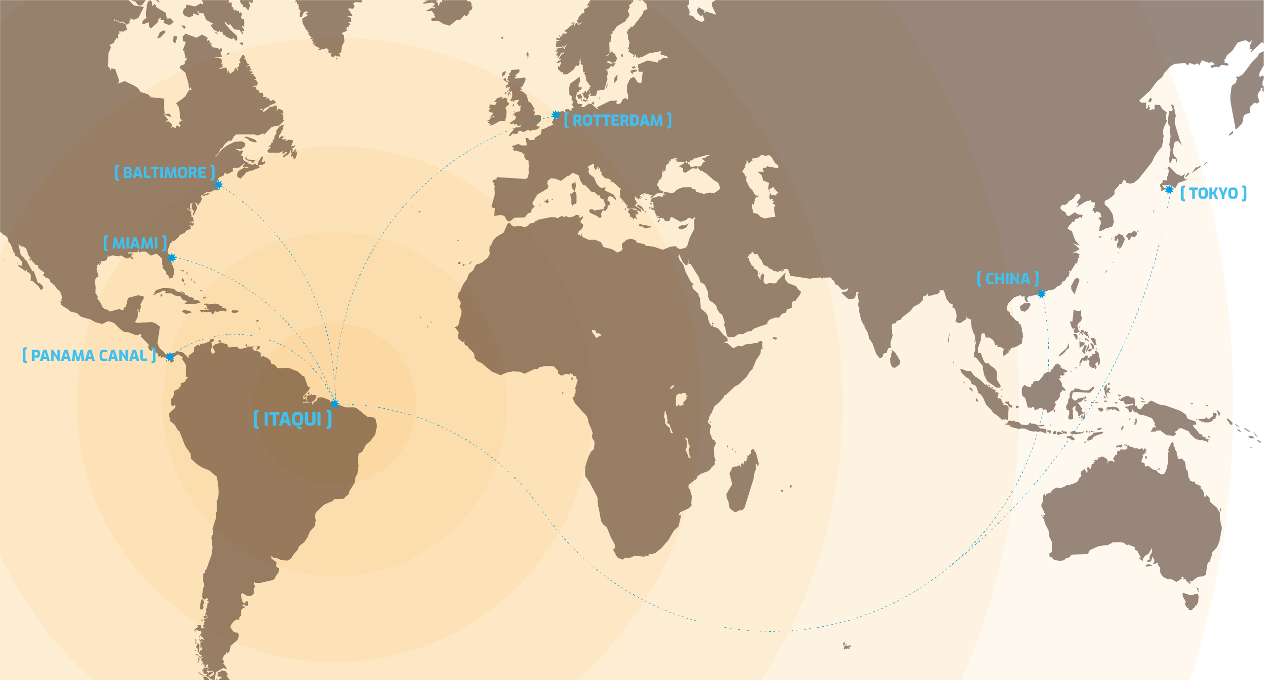
Maranhao is one of the top logistic hubs of Brazil future development, mainly because of its harbour conditions. It has some special features that make it one of a kind.
– Unique natural conditions: 23meters fretwork protected inside San Marcos bay.
– Its situation at the north coast of Brazil makes Maranhao the nearest port to the USA, Europe and Asia crossing the Panama Canal.
– It is the very end and natural way out for the corridor that runs along the center and to the north of the country. Either way by road, train or sailable rivers products and commodities are carried through it from Maranhao, Tocantins, Piaui, Para, Goias and Matto Grosso states.
Infrastructure

Retroporto Occupation
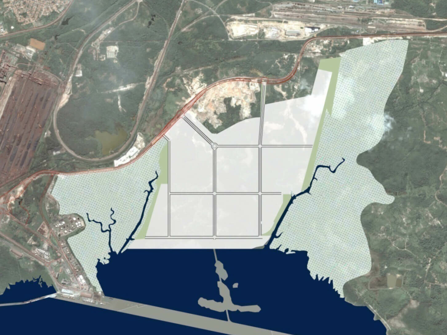
Master Plan
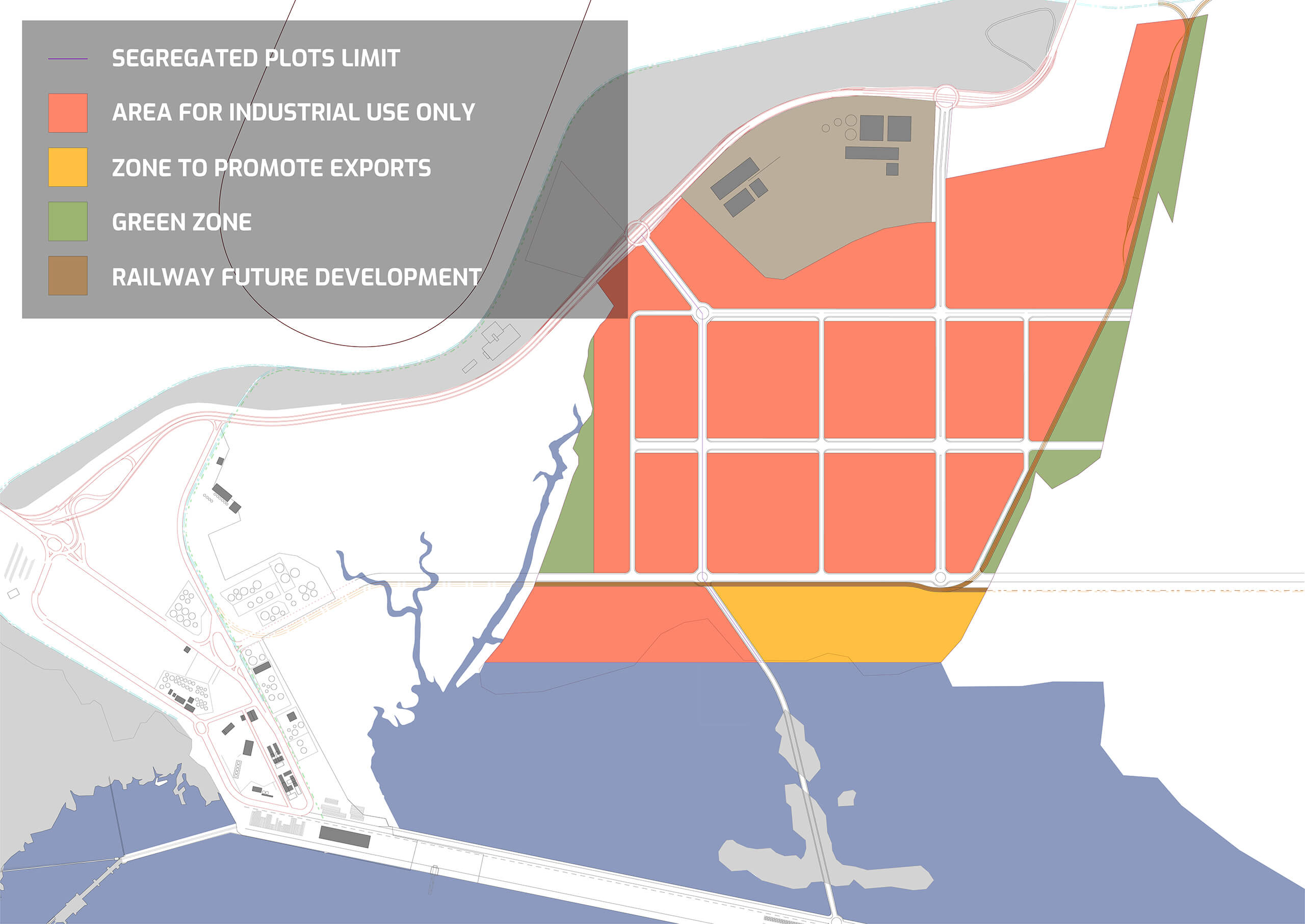
Surface Chart
| Zoning | Area | % |
|---|---|---|
| Industrial Plot | 3.149.775,31 m2 | 80,34 % |
| Railway | 73.232,72 m2 | 1,87 % |
| Roads | 412.263,10 m2 | 10,52 % |
| Public Green Zone | 285.297,87 m2 | 7,28 % |
| Total Ambit | 3.920.569,00 m2 | 100,00 % |
Contact
Robert William
Conselheiro
Avenida do Vale, 13
sala 409, Edifício Zircônio
Renascença
CEP 65075-660
São Luís/MA